
Do you want to learn more about MSP education? Here you will find some reports and literature that might interest you.
 |
Stephen Jay et al. This handbook has been produced by the Erasmus+ Strategic Partnership on Marine Spatial Planning. It offers guidance on developing a higher education introductory module on marine / maritime spatial planning (MSP) as part of a wider accredited programme. This could be a programme focusing on spatial planning, marine science or management, geography, or any other relevant discipline. The handbook is intended to support the development of an undergraduate or masters’ level module, with adjustments being made as appropriate. The handbook may be used to support the development of modules internationally. It may be of particular benefit in the context of the rollout of MSP in the European Union, with implementation of the ‘Maritime Spatial Planning Directive’ and associated national MSP systems, growing cooperation in Europe’s regional seas and attention now turning to the EU’s outermost regions in the world’s oceans. |
 |
Stephen Jay, Hannah Jones Towards a framework for higher education for marine spatial planning The implementation of marine spatial planning (MSP) is bringing together a new body of practitioners who are largely drawn from related professions but have relatively little specific education, training or qualifications in MSP. This is partly due to the newness of the field and the limited opportunities available for personal development. Educational capacity is developing, though MSP content is mostly being added on to existing marine-related programmes. Taking a learning-centred approach, this article seeks to contribute to the development of higher-education curricula that can support a newly-forming MSP practitioner and research community. The proposals presented here are based upon existing educational provision, the ongoing experience of an Erasmus+partnership in MSP teaching and learning and the results of a related survey. This lays emphasis upon enabling students: to gain a comprehensive, cross-disciplinary body of knowledge and understanding; to develop a strong set of academic and professional skills to underpin MSP practice and research; and to benefit from a variety ofmethods of learning, teaching and assessment that are designed to facilitate autonomous learning and skills development. Educators should be encouraged to respond to current practice needs and work collaboratively with students in developing courses that respond to their concerns and ambitions. |
 |
Lodewijk Abspoel et al. Communicating Maritime Spatial Planning: The MSP Challenge approach The MSP Challenge uses game technology and role-play to support communication and learning for Marine/Maritime Spatial Planning. Since 2011, a role-playing game, a board game and a digital interactive simulation platform have been developed. The MSP Challenge editions have been used in workshops, conferences, education, as well as for real life stakeholder engagement. The authors give an overview of the development of the MSP Challenge and reflect on the value of the approach as an engaging and ‘fun’ tool for building mutual understanding and communicating MSP. |
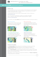 |
Magali D. do Patrocinio Goncalves The MSP Challenge workshop manual is a guide to plan a workshop with the MSP Challenge simulation platform. First, the manual helps to conceptualise the workshop, including the phases and duration of each workshop phase. Next, it gives concrete examples of using the platform to teach MSP or engage stakeholders in the MSP process. Finally, requirements and practical advice are given for online and face-to-face workshops. The manual was developed under the knowledge flows project. |
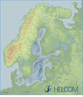 |
Baltic Sea Region Maritime Spatial Planning Data Geospatial data is essential for marine spatial planning, in order to get an overview of existing human activities, prevailing environmental conditions, and important ecosystem components. For the Baltic Sea, the HELCOM Map and Data Service provides geospatial data on a variety of topics. The folder provided through a downloadable archive (zip, 740MB) contains data from the HELCOM geoportal. This provides students (and lecturers) with a comprehensive set of data for this sea basin, to explore geospatial data relevant for MSP and to design GIS exercises based on this data. The folder contains a ‘readme’ file, which should be consulted before using the data. Each shapefile and raster dataset is also accompanied by a ‘readme’ file, which contains a link to the metadata that specifies use constraints and citation requirements. As a general rule, HELCOM should always be acknowledged as the data source or provider. The data were downloaded from the HELCOM Map and Data Service in the summer of 2020. Some of the data may have been updated in the meantime. The latest data can be accessed by exploring the HELCOM Map and Data Service or through the metadata links provided in the downloadable folder. However, the data downloaded in 2020 is sufficient for gaining an overview of MSP-relevant data and for other educational purposes. A guideline explaining how to use the data in standard Geospatial Information Systems software and exemplary exercises will be published here soon. |

Image source : |
Juliette Davret, Brice Trouillet Inventory of geoportals related to marine spatial planning approaches around the world. The increase in human activities at sea and the extraction of marine resources requires an increasing level of knowledge about the marine environment. To best meet the objectives of MSP, planning is supported by geographical information. This information has an essential place in the planning process and is increasingly supported by online geoportals. These allow the visualization of maritime spatial information and in some cases marine spatial plans. |